I. The Chicago Plan
I have written before about the relationship between spaces for production and the spaces for consumption which must both exist in cities. It is a slow dance that has been going on for centuries, and it begs the following question: if there is a slow dance, when does the music change?
Imagine it is fall in the year 1909. Daniel Burnham and Edward H. Bennett have just published their grand master plan for the City of Chicago. This plan promises to expand the city in a new way: not outward as in the 19th century, but inward, taking on greater density and improving quality of life. The 50 or so years prior had been defined primarily by the United States’ aggressive westward expansion by railroad, but San Francisco had been reached already around 1870, and the next chapter of the country’s development was underway. As Burnham himself wrote: “The people of Chicago have ceased to be impressed by rapid growth or the great size of the city. What they insist asking now is, How are we living?” To answer that question, the plan implemented a strategy which in my mind was key to its success: targeting axes of movement, and making them more efficient. From Ancient Rome to Paris, any city plan worth its salt knows to focus on paths instead of places. Likewise, the 1909 Chicago Plan called for an enlarged network of parks and public spaces, standardized streets which prioritized access to downtown, and critically, consolidated freight and rail lines that supplied goods to & from the city.
This last part is most interesting to me because its results are less tangible. Infrastructure, practically by the subterranean hint in its name, is difficult to see. It may have come to acquire this quality because of the belt-tightening legacy that city plans like Burnham’s imposed on it.

A large plot of land close to downtown and on the waterfront was to be granted to the Illinois Central Railroad company. That site would undergo an exemplary transformation 88 years later, when Millennium Park was built on top of the site. The park is now the city’s most popular destination, and most visitors are unaware of the fact that trains are passing under their feet. One can argue that the strongest impetus for the renewal was the symbolic millennium year, but I say that even more important was the 100-year anniversary of Burnham’s and Bennett’s Chicago Plan.
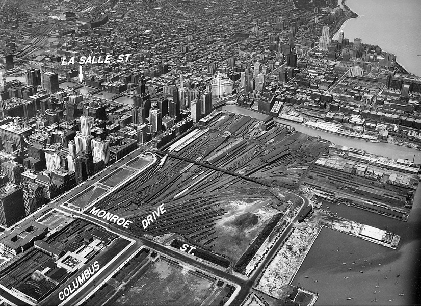
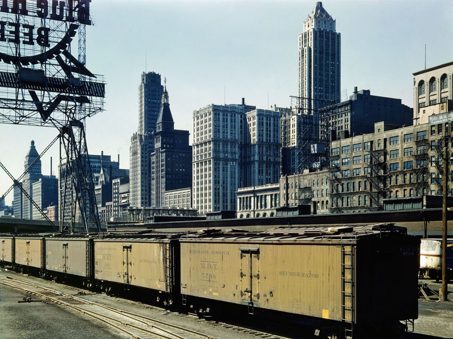
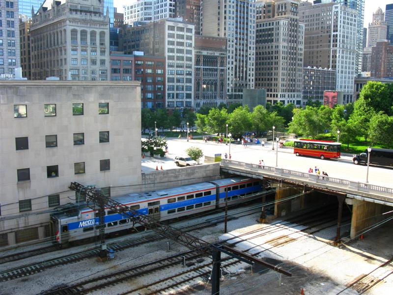
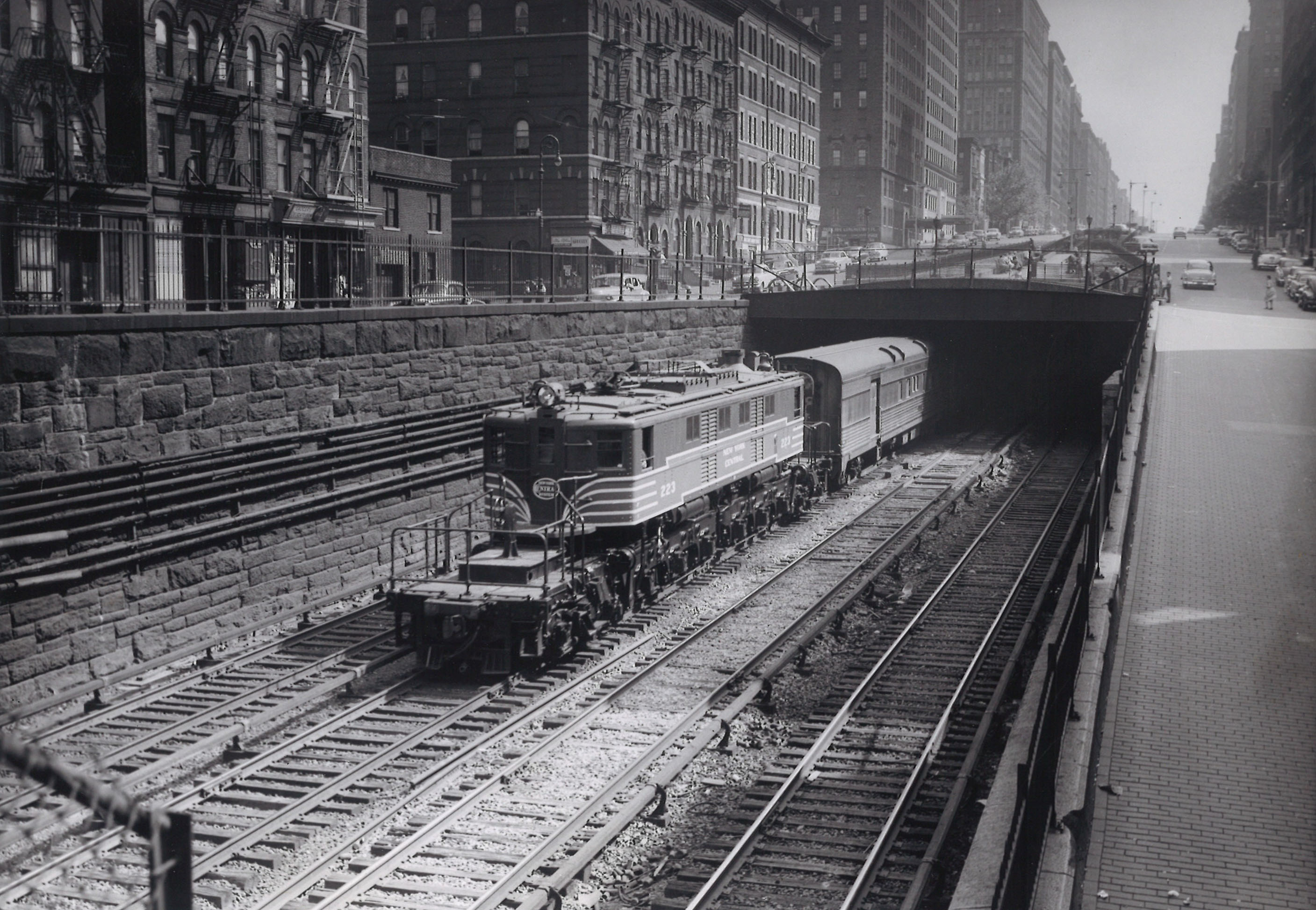
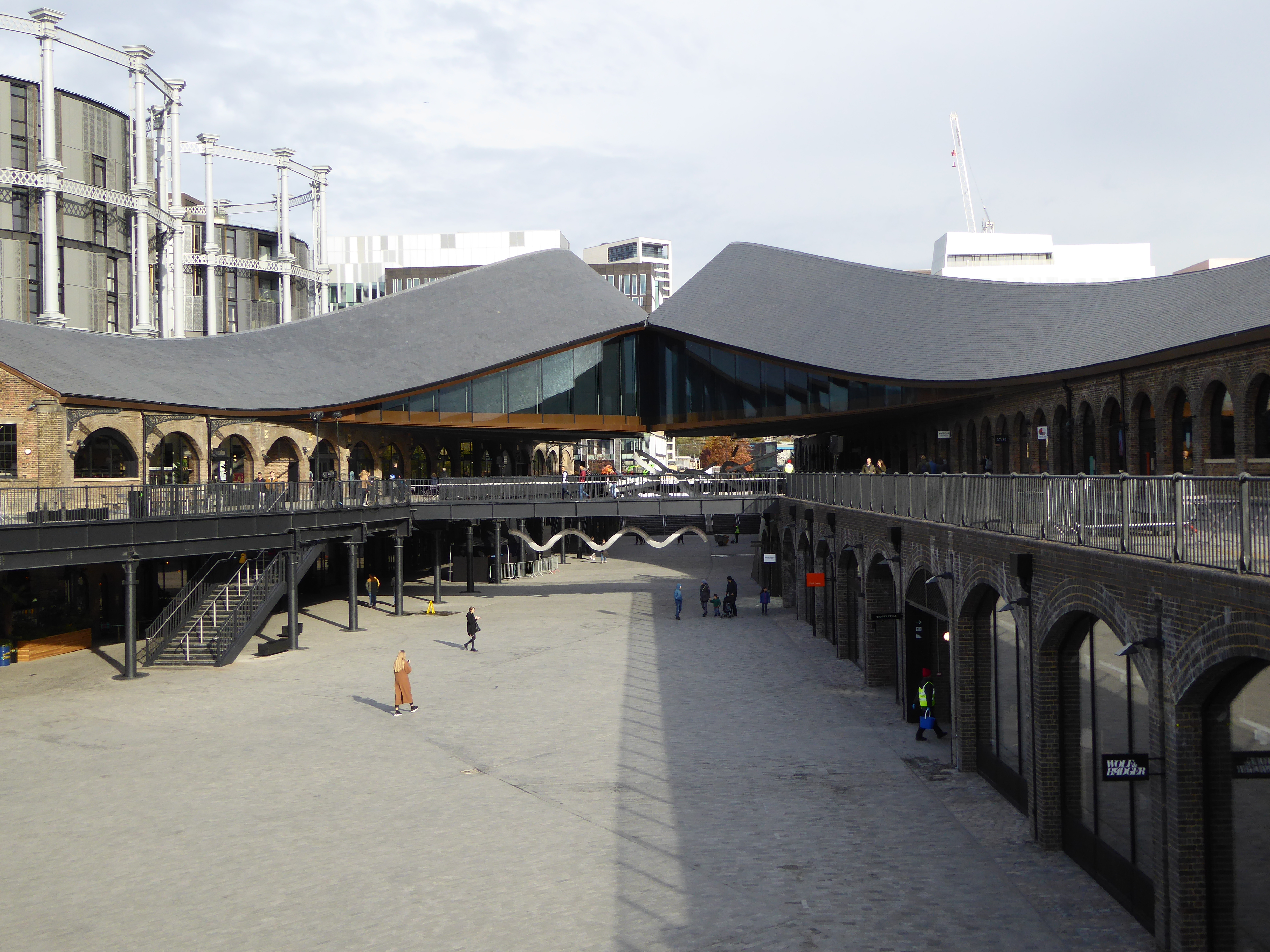
I think Burnham’s proposal was heavily motivated by his rejected proposal for the mega-development of New York Central Railroad’s Grand Central Terminal just a few years earlier. That terminal, and the strip of real estate known as Park Avenue that stretches from it, is a lasting model of “urban renewal:” cover up your infrastructure, create real estate out of thin air, and capture the value when JP Morgan, The Union Club, or half the city’s pediatricians set up shop.
II. Let’s look at some other examples
The Fulton Fish Market, less of a piece of infrastructure but nonetheless an important organ for NYC commerce and industry, did last almost 200 years from the 1820s (coinciding with the opening of the Erie Canal) to 2005 in its South Street location. However, in the 1930s Mayor LaGuardia oversaw the construction of a new steel building to house operations when the previous wooden one collapsed into the East River from rot. Thereafter, The South Street Seaport Museum opened in 1967, the multi-story Pier 17 shopping center and music venue opened in 1983, and finally, the fish market itself relocated to Hunt’s Point in the Bronx in 2005. In retrospect, the site’s history divides into roughly 100 years of active industry, followed by 100 years of “urban renewal,” which was a harbinger for the transformation of waterfronts more generally. Battery Park City (which was paired up in proximity to the World Trade Center), Hunters Point Queens, Brooklyn Navy Yard, Industry City, Brooklyn Bridge Park, and more have all replicated the model, infilling land with recreation space, turning warehouses into shops, and blasting land values through the roof.
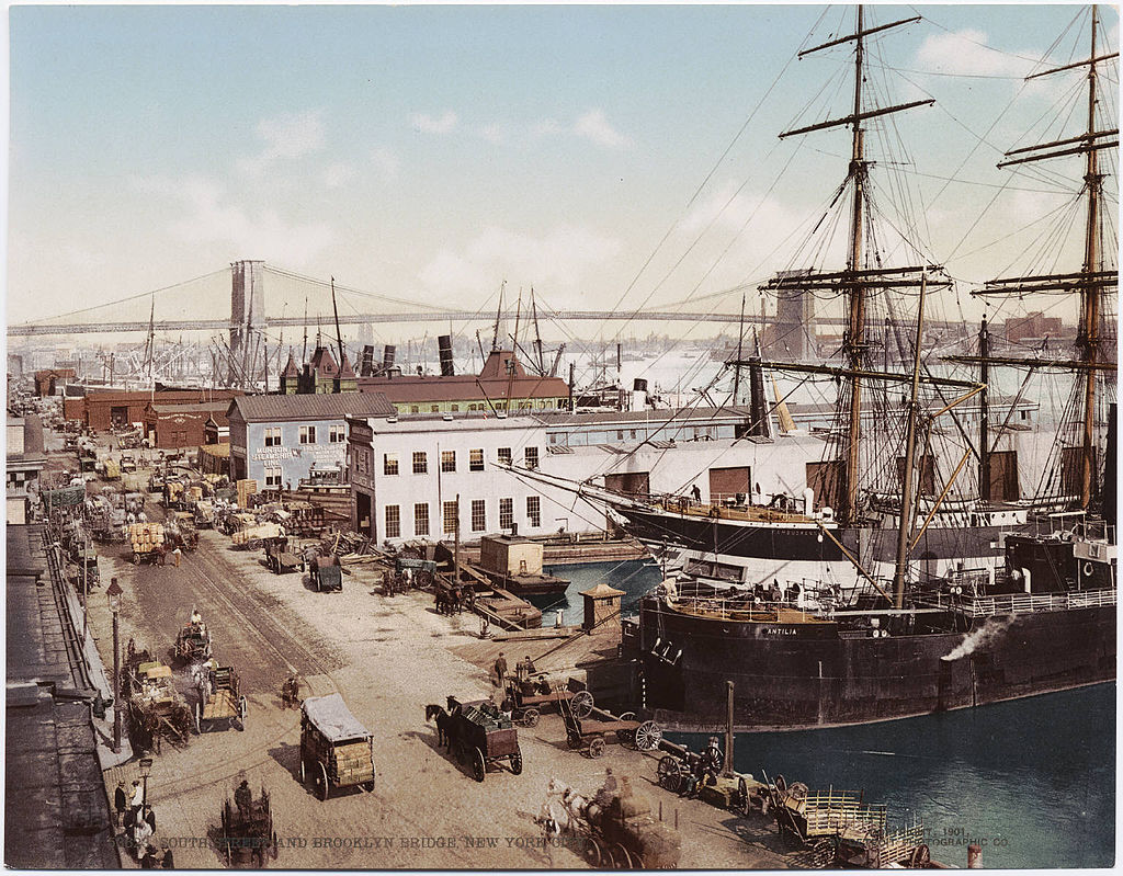
South Street Seaport, 1901. Photo credit Detroit Photographic Company, via NY Boat Charter, public domain.

South Street Seaport, circa 2010. Photo credit Jan Ainali, via Wikimedia Commons, license GNU FDL.
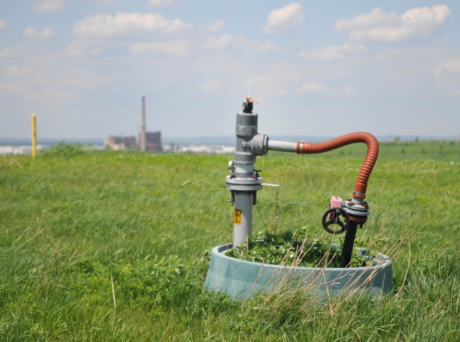
Fresh Kills Landfill, meanwhile, had a much faster life cycle. Merely 7 years after opening in 1948 it already became the world’s largest landfill (Go New York!). After management debacles, questions about sanitation’s entanglement with the Mafia, and the gradual outsourcing of garbage disposal to other sites, the City finally closed Fresh Kills down in 2001, just about 50 years after opening. Since then, a slow effort has been underway to transform the site into a public park and natural reserve, mainly by building directly on top of the garbage. Methane is controlledly harvested for domestic heating of nearby residences. The pace was quicker, but again we see an example of a piece of important infrastructure being covered to create land for public use.
Lately, I’ve noticed all the rage shift back to rail yards. Truckee, CA, Sioux Falls, SD, Norfolk, VA, Sacramento, CA, Hoboken, NJ, Charlotte, NC, Philadelphia, PA, and Santa Fe, NM, are just a few of the cities around the country that are throwing development dollars at their centenarian rail yards, having witnessed the massive impact of projects like Hudson Yards. At this point, it seems all you have to do is add the word “Yard” to a project to make it sell.
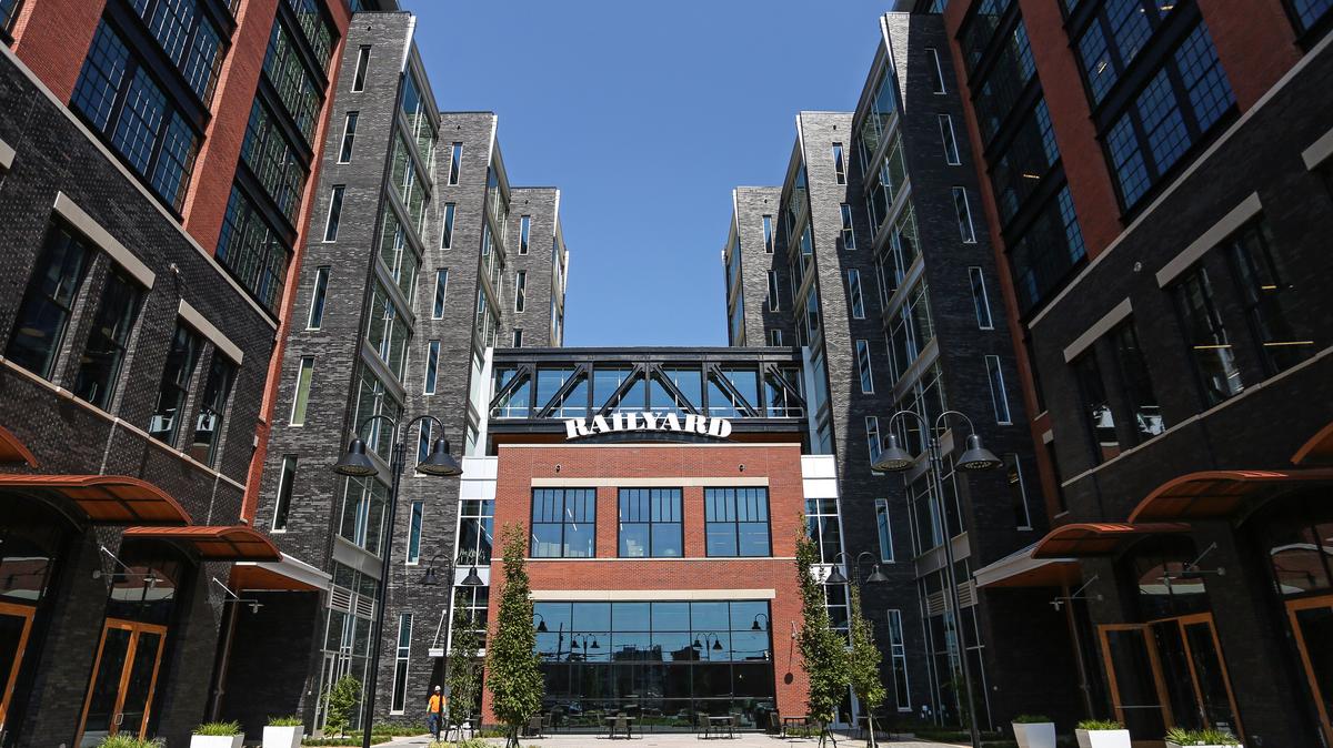
Image via Charlotte Business Journal.
III. Symbiosis
If this symbiosis is inherent to cities, then what will its next evolution look like? To answer that question one simply needs to ask: what type of infrastructure is currently a) occupying a lot of territory, and b) vital to the economy? The most obvious answer, to me, is automobiles.
Now, I’m not saying that cars will disappear, just like trains and ships haven’t disappeared despite the redevelopment they’ve absorbed. What I am suggesting is that pressure is increasing on cars to share the vast swaths of territory that they have captured over the past hundred years or so. The United States Congress passed The National Industrial Recovery Act (NIRA) in June 1933, kicking off the New Deal. The NIRA in turn created the Public Works Administration, which oversaw the construction of over 10,000 road-building projects across the country and spent approximately 5% of US GDP that year ($3.3 billion budget over $60 billion GDP). Nowadays, cars have entangled themselves into our lives, from highways cutting through neighborhoods to Amazon trucks making our on-demand deliveries to our lingering oil addiction. This entanglement also sprouts all manner of auxiliary infrastructure, like parking spaces, gas stations, and auto body shops. So what will happen to these territories as cars slowly get pushed out of dense city centers? We are already seeing early hints of human-scale uses infiltrating highways and parking garages. The 100-year mark will be 2033. Let’s revisit then.


The thought of redesigning a highway into a pedestrian boulevard or a parking building into a hotel would make any architect or planner salivate. But why stop there? Let’s look further into the future. What’s another piece of public work that we are dependent on? Airplanes.
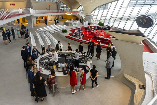
The explosion of commercial air travel began in the 1950s, not far behind automobiles. Airports are still getting built and expanded the world over, so it’s hard to tell if we are at a peak or not, but what will happen when oil stops being our main source of energy? Or when flight shaming becomes a generational pandemic? Suddenly those airports that are encroaching over sensitive wetlands and quiet residential neighborhoods will start to look much more wasteful. There are already examples of their takeover in Berlin and New York City.

This isn’t just about Infrastructure Week; the first half of the 21st century may prove to be an Infrastructure Era. Many urban centers in the West were rocketed to prominence by building booms centered around transportation and manufacturing in the 19th century, while in the 20th century and in the early 21st century, building booms have mostly been fueled by service economies and speculation. That is: moving white-collar desk workers from place to place, creating spaces for them to live happily as consumers, and outsourcing the production of that which is consumed. Notice: the inhabitation of revitalized areas of former industry is largely done by a consumer, service-based economy: marketers, designers, and managers eating at Time Out Markets, buying Coach bags, and opening bank accounts. What we talk about when we talk about “development” seldom includes bridges and factories anymore. To wit: manufacturing zoning districts have all but disappeared from Manhattan, so even a brewery has to find space in Queens, the Bronx, or Brooklyn.
The budding 21st century is a good time for citydwellers to come to terms with this symbiosis. We have to be deliberate about the winners and losers of urban renewal, acknowledge what is displaced when a warehouse becomes a restaurant, and anticipate where the city will transform next. The fact is that as long as humans stream to cities in large volumes in search of the good life, they will continue to need equally large volumes of space dedicated to the production of the good life’s ingredients. What will the next dance between public space and industry look like? When will the music change? And will the song be a remix of a old hit, or something new entirely?
